#3273: Latitude and Longitude
Permalink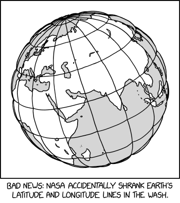
Transcript
[An image of the Earth showing most of Europe, Asia, Africa, and the Indian Ocean, with horizontal latitude lines and vertical longitude lines looking like a balloon tied tightly with string - like the lines are squeezed down into the surface.]
[Caption below the panel:] Bad news: NASA accidentally shrank Earth's latitude and longitude lines in the wash.
(title text) NGS and IERS are complaining that they left CLEAR instructions to set the washing machine to WGS84 (G2296) instead of WGS84 (G730).


(Sourced from explainxkcd.com)
Title text:NGS and IERS are complaining that they left CLEAR instructions to set the washing machine to WGS84 (G2296) instead of WGS84 (G730).