#2951: Bad Map Projection: Exterior Kansas
Permalink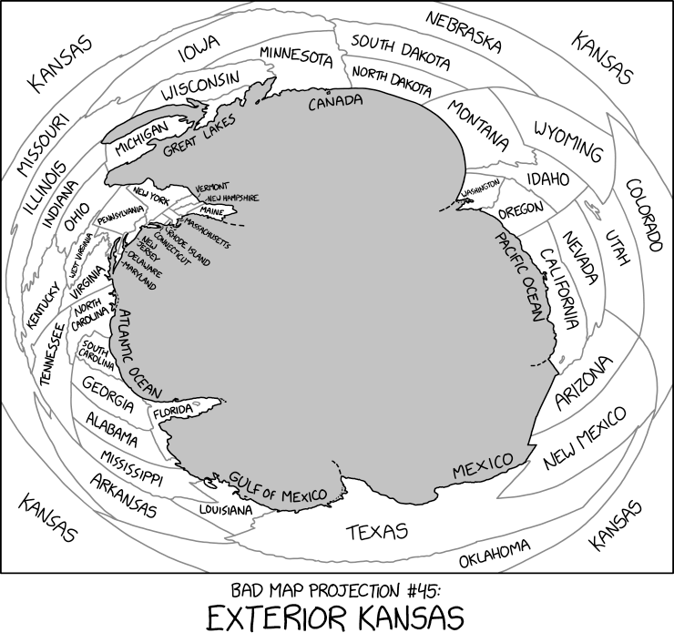
Transcript
| 40x40px | This is one of 36 incomplete transcripts: Map description could be improved? Do NOT delete this tag too soon. If you can fix this issue, edit the page! |
[A distorted map of the contiguous United States with the states labeled, where the Atlantic and Pacific coasts and the Canadian and Mexican borders are located closest to the center, with there being a gray void in the middle of the map, while the central U.S. states are distributed in the edges of the panel, with Kansas being in all of the four corners of the map.]
[Caption below the panel:]
Bad Map Projection #45:
Exterior Kansas
(Sourced from explainxkcd.com)
Title text:Although Kansas is widely thought to contain the geographic center of the contiguous 48 states, topologists now believe that it's actually their outer edge.