#2921: Eclipse Path Maps
Permalink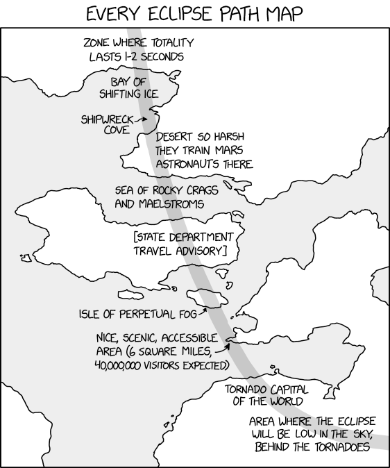
Transcript
Every eclipse path map
[A grey band representing the totality path of an eclipse travels along the map across several labels. Labels along the path from top to bottom:]
[On land] Zone where totality lasts 1-2 seconds
[On water] Bay of shifting ice
[On water] Shipwreck cove
[On land] Desert so harsh they train Mars astronauts there
[On water] Sea of rocky crags and maelstroms
[On a big island; label in square brackets] State department travel advisory
[On a small island] Isle of perpetual fog
[On small part of a peninsula] Nice, scenic, accessible area (6 square miles, 40,000,000 visitors expected)
[On land] Tornado capital of the world
[On land] Area where the eclipse will be low in the sky, behind the tornadoes
(Sourced from explainxkcd.com)
Title text:Okay, this eclipse will only be visible from the Arctic in February 2063, when the sun is below the horizon, BUT if we get lucky and a gigantic chasm opens in the Earth in just the right spot...